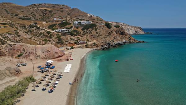
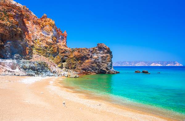
Nestled within the azure waters of the Aegean Sea, Milos Island beckons travelers seeking an authentic Greek experience away from the bustling crowds. Located in the Cyclades island group, this enchanting island offers a captivating blend of natural beauty, rich history, and warm hospitality. Renowned for its pristine beaches with striking rock formations and crystal clear waters, Milos is a paradise for beach lovers and nature enthusiasts alike.

But it’s not just the picturesque coastline that makes this island special; Milos also boasts a fascinating ancient past, showcased through its archaeological sites and charming traditional villages.
History and Culture of Milos Island
Milos Island, located in the Aegean Sea, boasts a rich history and vibrant culture. Its history dates back to ancient times when it was inhabited by the Minoans, followed by the Mycenaeans and later the Dorians.


The island flourished during the Classical period, renowned for its wealth derived from its mineral resources, particularly obsidian. Milos gained further significance as a center of early Christianity during Byzantine rule.
Today, remnants of its past can be explored through archaeological sites like the ancient theater and catacombs. The island’s culture is deeply rooted in traditional customs, including folk dances and local festivals that celebrate Milos’ unique heritage.
Exploring the Stunning Beaches of Milos
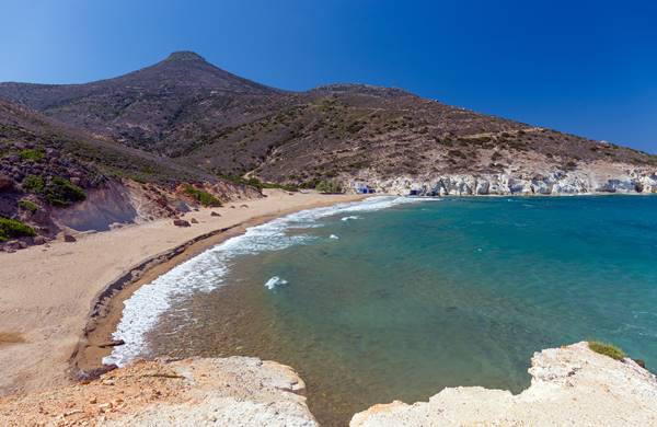
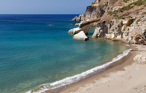
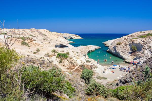
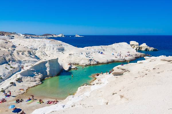
Milos Island boasts an array of breathtaking beaches that captivate visitors with their natural beauty. From secluded coves to expansive stretches of golden sand, Milos offers a beach for every preference. Sarakiniko Beach, with its lunar-like landscape and crystal-clear turquoise waters, stands out as one of the island’s most unique and iconic spots.
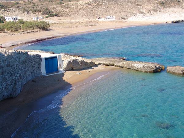
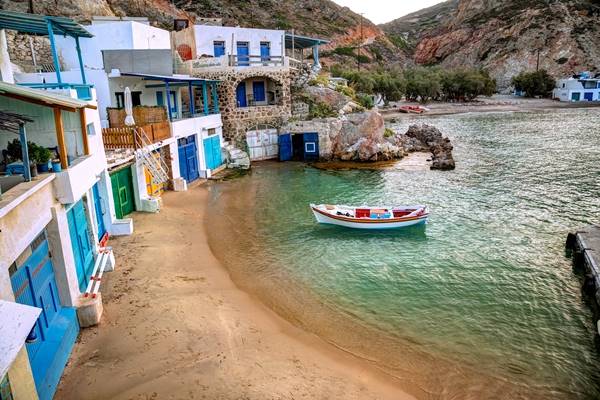
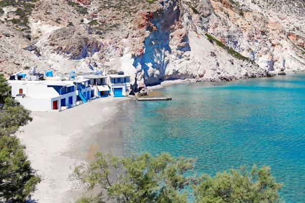
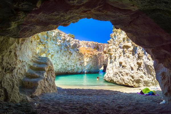
For those seeking tranquility, Firopotamos Beach enchants with its picturesque fishing village backdrop and calm azure sea. Meanwhile, Tsigrado Beach entices adventurers with its hidden caves and dramatic rock formations.
Achivadolimni Beach

Agia Kiriaki Beach
Agios Ioannis Beach
Agios Konstantinos
Alogomandra Beach
Ammoudaraki Beach

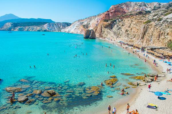
Firiplaka Beach
Firopotamos Small Beach
Firopotamos Beach
Fourkovouni Beach

Gerakas Beach

Gerontas Beach
Kapros Beach
Kleftiko Beach
Lagada Beach

Mytakas Beach

Old Sulfur Mines – Paliorema – Thiorichia Beach
Pachena (Pachaina) Beach
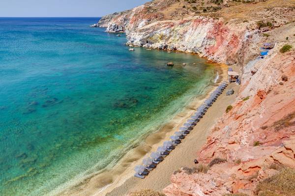
Paleochori Beach
Papafragas Beach
Papikinou Beach
Plathiena Beach
Pollonia Beach

Provatas Beach
Sarakiniko Beach
Sikia Beach

Triades Beach

Tsigrado Beach

Unearthing the Rich Geological Wonders of Milos Island
Milos Island in Greece boasts a captivating geological landscape that has long fascinated both scientists and nature enthusiasts. Renowned as an open-air geological museum, this enchanting island offers a plethora of breathtaking wonders waiting to be discovered.
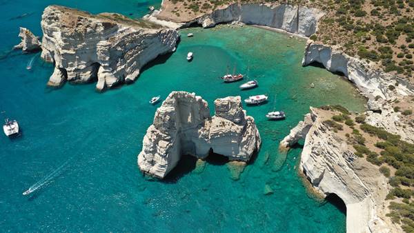
From its unique volcanic formations, stunning mineral-rich beaches, to its vibrant array of colorful rocks, Milos provides a rich tapestry for exploration. Visitors can marvel at the iconic Sarakiniko beach with its moon-like terrain or venture into Kleftiko’s sea caves sculpted by centuries of relentless waves.
Milos Things to See
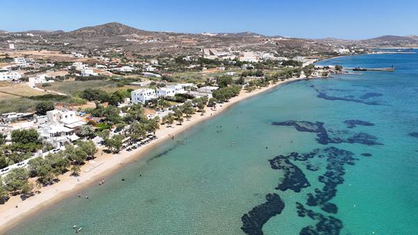
Achivadolimni Lake
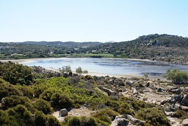
Achivadolimni is one of the few places on Milos where the landscape changes noticeably with the seasons. In winter and spring, rainwater collects in the shallow basin behind the beach, forming the island’s largest natural wetland. By late summer, parts of the lake may shrink considerably, revealing a different side of the landscape. This seasonal rhythm makes every visit slightly different.
A walk around the lake is the best way to appreciate its character. The area attracts a variety of migratory and resident bird species, particularly during the cooler months, making it an interesting stop for birdwatchers and nature photographers. Bring binoculars if you have them; birds are often easier to spot from a distance without disturbing their habitat.
The surrounding dunes and low vegetation create a landscape unlike the volcanic cliffs and rocky coves that Milos is better known for. Several informal paths cross the area, offering opportunities for gentle walks with views over both the wetland and the bay. The elevated sections provide excellent vantage points for observing the interaction between the lake, the sea and the surrounding hills.
Achivadolimni is also closely connected to one of the island’s longest sandy beaches. After exploring the wetland, many visitors continue to the shoreline for swimming, paddleboarding or simply relaxing by the water. The beach is often less crowded than some of Milos’ more famous coastal spots, giving the area a quieter atmosphere.
For those interested in local ecology, Achivadolimni offers a chance to see a side of Milos that is frequently overlooked. The lake supports a distinct ecosystem and serves as an important resting point for birds crossing the Aegean. Information panels are limited, so exploring at a slower pace and observing the landscape carefully is often the most rewarding approach.
The area is particularly appealing in the early morning or late afternoon, when bird activity increases and the changing light highlights the contrast between the wetland, the sand dunes and the sea beyond. Rather than being a destination for a single attraction, Achivadolimni is a place best experienced through observation, walking and spending time in a landscape that reveals its details gradually.
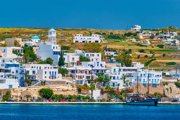
Adamas
Adamas is often the first place visitors encounter when arriving in Milos, but it is worth more than a quick pass through on the way to the beaches. The village developed around the island’s natural harbour, one of the largest and safest in the Aegean, and much of daily life still revolves around the waterfront.
A walk along the port is the simplest way to get acquainted with the area. Fishing boats, excursion vessels and ferries share the harbour, creating a constantly changing scene throughout the day. Early morning is particularly interesting, when local fishermen return with their catch and the town is still relatively quiet.
Several of Milos’ most important museums are located within walking distance of the centre. The small but informative Archaeological Museum provides insight into the island’s ancient past, while the Mining Museum explains how Milos’ volcanic geology shaped its economy and settlement patterns for thousands of years. Together, they offer useful context for understanding many of the landscapes visitors encounter around the island.
Adamas is also the main departure point for boat trips. Cruises around the coastline leave regularly from the harbour, providing access to sea caves, remote beaches and sections of the island that cannot be reached by road. Even if you do not join a tour, spending time around the marina offers a close look at the vessels preparing for daily departures.
For those interested in architecture, the Church of Agia Triada stands above the harbour and offers a different perspective on the village. The elevated position provides views across the bay, particularly in the late afternoon when the harbour begins to fill with returning boats.
The village is also a practical place to explore local food. Rather than seeking out a specific attraction, many visitors simply spend an evening moving between cafés, bakeries and waterfront tavernas, observing the rhythm of the harbour after the daytime excursion boats have departed.
Adamas may not have the dramatic scenery of Sarakiniko or the colourful fishing houses of Klima, but it offers something equally valuable: a chance to understand how Milos functions beyond its postcard locations. The harbour, museums, churches and everyday activity combine to create a place that rewards unhurried exploration.
Aggeria
Exploring the area is largely about observing the landscape itself. The mine has altered the terrain in ways that are immediately visible, exposing layers of volcanic rock and mineral deposits that would otherwise remain hidden beneath the surface. The colours and textures of the excavated earth often contrast sharply with the surrounding hills, creating a landscape that feels both natural and industrial at the same time.
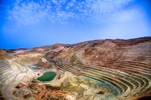
Visitors interested in photography may find the site particularly appealing. The geometry of cut slopes, access roads and exposed rock formations creates unusual compositions that differ significantly from the white cliffs and seaside villages found elsewhere on the island.
The surrounding area also provides insight into the scale of Milos’ mining history. Rather than focusing on a single structure or monument, the experience comes from understanding how mining has influenced the island’s economy, settlement patterns and landscape over time. A visit to the Mining Museum in Adamas before or after exploring the area can help place what you are seeing into a broader historical context.
As with many former and active mining areas, visitors should respect any restrictions, barriers or warning signs. The attraction here is not a curated tourist site but the opportunity to observe a working landscape that has played an important role in the story of Milos.
Ancient Theatre
The Ancient Theatre of Milos sits on a slope near Trypiti, positioned so that the stone seating faces outward toward the sea. It is small compared to the large theatres of mainland Greece, but its layout is still clearly readable: curved rows of marble seats cut into the hillside, a semicircle stage area, and the remains of structures that once framed performances.
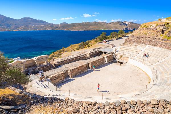
Walking up to it, the first thing you notice is how exposed it is. Wind passes through the site, and the soundscape shifts constantly between silence and distant movement from the village below. The marble has been worn smooth in places, especially along the lower rows, where people would have sat closest to the stage.
The structure dates back to the Hellenistic period and was later modified during Roman times, which becomes apparent when you look closely at the differences in masonry. Some sections feel more orderly, others more irregular, reflecting the changes in use over centuries rather than a single construction phase.

There is no reconstructed stage or modern staging area here, so the experience is mostly about reading the space as it is. From the upper rows, the view opens toward the bay and the coastline beyond Tripiti, which gives a sense of why this spot was chosen in the first place.
It is a short stop rather than a long visit, but it works well when combined with the nearby catacombs or a walk through the village above. The theatre itself does not demand much time; it leaves you with the impression of a place that has settled into the landscape rather than been separated from it.
Archeological Museum
The Archaeological Museum of Milos is set in Plaka, occupying a neoclassical building that feels more restrained than the objects it holds. The collection is not large, and that shapes the visit in a specific way: instead of moving through dense galleries, you move slowly between a handful of rooms where each piece has space to stand on its own.
Most of the exhibits come from across Milos and nearby islands, spanning prehistoric settlements through to the Roman period. One of the most discussed items is the plaster copy of the Venus de Milo’s original discovery context, which helps anchor the story of how the island became known far beyond the Aegean. The original statue is in the Louvre, but the museum gives enough surrounding material, fragments, inscriptions, and smaller finds, to understand what was happening locally at the time it was created.
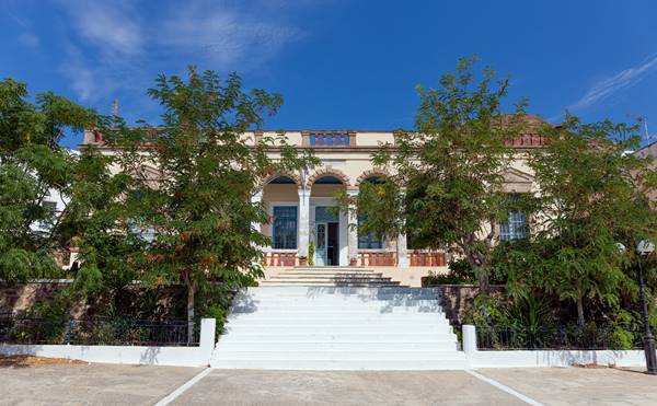
There are also everyday objects that come from ancient households and burial sites: pottery with uneven brushwork, stone tools, and small figurines that were never intended as display pieces but as part of ordinary use. These tend to stay with visitors longer than expected because they feel closer to how people actually lived on the island rather than how history is usually presented.
The upper floor opens onto a balcony overlooking Plaka and the surrounding hills.
Arkoudes – Bears
Arkoudes sits at the entrance of Milos northern harbour, where the coastline narrows and boats pass between the mainland and the small offshore rocks. The formation itself is natural, two vertical volcanic rocks shaped by wind and sea into outlines that resemble standing figures, which is where the name “Bears” comes from.

There is no built site here, just a pull-off along the road between Adamas and Pollonia where most people stop briefly. The viewing angle matters more than distance: from the right position, the rock shapes line up clearly against the water, while from others they can look more abstract or even disappear into the background.
Because it sits directly along the route to the northern part of the island, Arkoudes is often a short pause rather than a planned visit. Cars slow down, people step out for a few minutes, and then continue on.
The surrounding area is exposed to wind and salt, which has gradually carved the formations over time. There are no barriers or interpretation panels, so the experience is essentially observational: a quick reading of shape and position rather than a structured stop.
It works best as part of a drive along the coast rather than as a standalone destination
Catacombs
The Catacombs of Milos are set into the hillside near Trypiti, just below the Ancient Theatre. The entrance is unassuming, and the temperature drops noticeably as soon as you step inside, which sets the tone for the rest of the visit. What lies underground is a network of narrow passageways carved directly into the volcanic rock, arranged in short corridors with small burial niches cut into the walls.
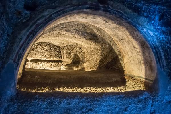
The catacombs were used from the early Christian period as burial grounds, and the niches, called loculi, line both sides of the corridors. Some remain empty, while others still contain faint traces of inscriptions or coverings that mark individual resting places. Lighting is minimal and carefully placed, so details appear gradually rather than all at once.
The site is relatively small and usually visited in combination with the nearby theatre.
Glaronissia Islets
Glaronissia sits just off the north coast of Milos, a cluster of small volcanic islets that rise out of the water in sharp, pale formations. From a distance they look almost geometric, like fragments of rock placed in a loose line across the sea. Up close, the shapes become more irregular, with vertical faces and narrow ridges carved by wind and salt.
There is no landing point on the islets themselves, so most visits happen by boat. The usual route passes slowly along the cluster, allowing time to notice how each rock formation differs in height and texture. Some are steep and angular, while others slope more gently toward the water, with sections that have been undercut by waves over time.
The water around Glaronissia is typically very clear, and boats often pause nearby for swimming stops when conditions allow. The contrast between the light coloured rock and the deeper blue sea is most visible when the sun is high, when the edges of the islets appear almost bleached against the water.
What makes the area distinctive is not any single landmark but the way the formations sit apart from the main island, creating a short stretch of sea that feels unusually open. Even on brief boat trips, the passage between Milos and the islets becomes a defined part of the experience rather than just transit.
Glaronissia is usually included in wider coastal cruises around Milos, and it functions less as a destination and more as a point where the geology of the island continues into the sea in a visible, fragmented form.
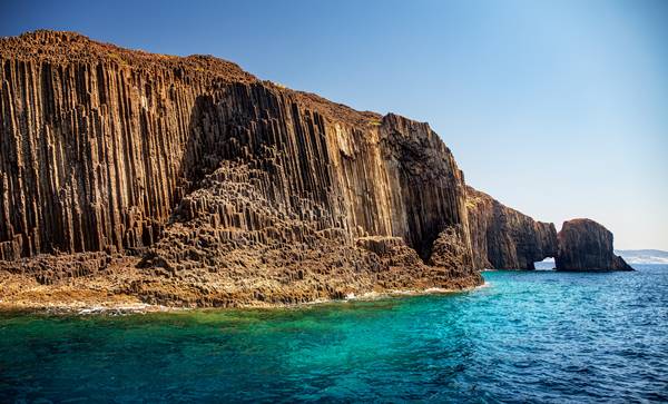
Kleftiko
Kleftiko is one of those places that is difficult to understand from photographs alone. The white rock formations are certainly impressive, but what makes the area memorable is the way you move through it. The landscape is not a single beach or viewpoint; it is a maze of sea passages, narrow openings, arches, caves and detached rock pillars scattered along the southwestern coast of Milos.
Most visitors arrive by boat, which remains the easiest and most rewarding way to experience the area. As the vessel approaches, the coastline gradually breaks apart into separate formations. Some rocks stand alone in the water, while others are connected by natural bridges and tunnels large enough to swim through.
Swimming is the main activity here. The water is often exceptionally clear, allowing you to see submerged rock formations several metres below the surface. Many visitors spend their time moving between caves and openings in the cliffs, discovering small chambers where sunlight enters through gaps above and reflects off the water onto the rock walls.
The history of Kleftiko adds another layer to the landscape. Its secluded coves and hidden inlets provided shelter for pirates and smugglers during previous centuries. Looking at the coastline from sea level, it becomes easier to understand why. From a distance, many of the entrances are difficult to distinguish from the surrounding cliffs.
For those arriving by hiking trail, the experience is entirely different. The route across the dry, rugged terrain of western Milos eventually reveals the coastline from above, offering a broader view of the rock formations before the descent toward the sea. It is a demanding walk but one that highlights how isolated this part of the island remains.
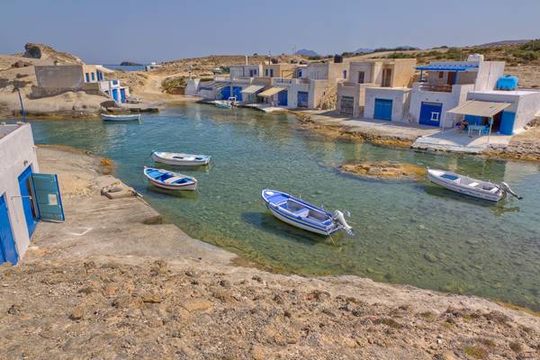
Klima Village
Klima is one of the few places on Milos where the relationship between the village and the sea remains immediately visible. The settlement was built directly at the water’s edge, and its famous syrmata (the brightly coloured boat houses) were designed for a practical purpose long before they became one of the island’s most photographed sights. Fishermen would store their boats on the ground floor during winter and live in the rooms above.
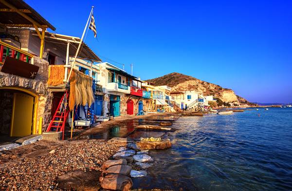
Walking through Klima takes very little time, but it rewards slow observation. The narrow lane running along the waterfront passes rows of boat houses painted in different colours, each reflecting individual family choices rather than a planned design. Some doors are freshly painted, others show years of exposure to salt and sun. The variety is part of what makes the village feel lived-in rather than preserved.
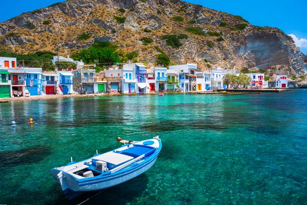
The shoreline itself is worth exploring. Small stone steps descend directly into the sea, fishing boats remain tied up outside many of the houses, and the sound of water moving beneath the buildings is a constant presence. Unlike many traditional settlements, there is almost no separation between architecture and coastline.
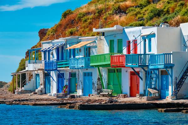
Photography draws many visitors here, but Klima is equally interesting for those curious about local maritime life. The village offers insight into how coastal communities adapted to the island’s geography, creating homes that functioned as both residences and working spaces. Looking closely at the boat garages, ramps and storage areas reveals details that are easy to miss when focusing only on the colours.
Klima is particularly pleasant in the evening when the western-facing coastline catches the last light of the day. The changing reflections on the water and the coloured facades create a different atmosphere from the busy beaches elsewhere on the island. Many visitors stay until sunset, not because of a specific event, but because the village naturally encourages people to linger.
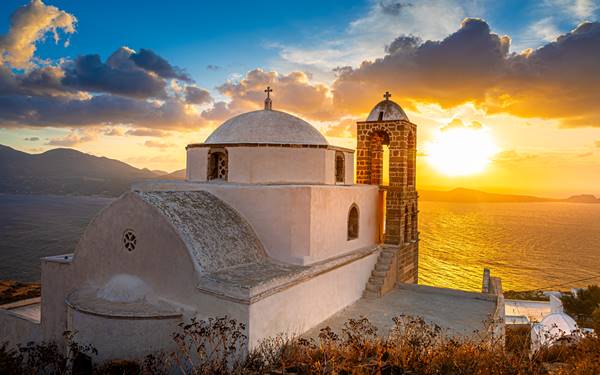
Korfiatissa
Perched at the highest point of Plaka, Panagia Korfiatissa offers one of the most expansive views on Milos. Reaching the church involves a walk through narrow village lanes that gradually lead to the hilltop. The building itself is modest, with a white façade, blue dome and traditional Cycladic design. Its real appeal lies in its location. From the courtyard, visitors can look across the bay, surrounding villages and the island’s volcanic terrain. The church is particularly popular in the late afternoon, when changing light reveals new details in the landscape.
Mandrakia Village
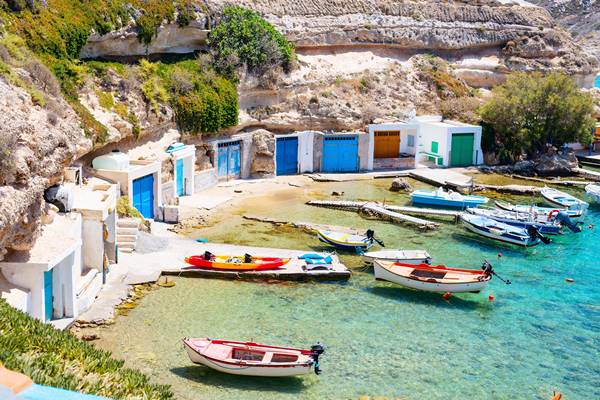
Mandrakia is one of the smallest fishing villages on Milos, but its layout makes it immediately distinctive. The settlement wraps around a narrow natural inlet where fishing boats are sheltered inside a protected harbour carved into the rock. Rather than facing a broad waterfront, many of the village’s boat garages and houses are built directly around this compact basin, creating a close connection between daily life and the sea.
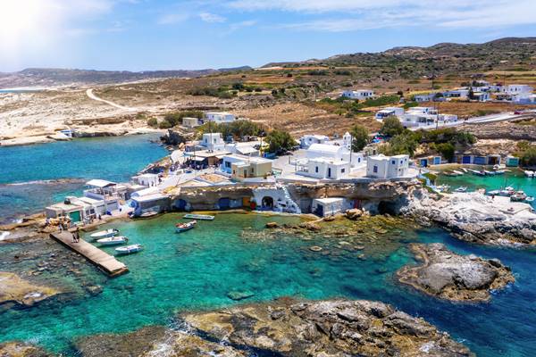
Walking through Mandrakia is best done slowly. The whitewashed buildings, blue painted doors and traditional syrmata are part of the appeal, but the village is more interesting when you notice the details: fishing nets drying in the sun, ropes coiled beside boat ramps, and small workshops tucked between homes. Unlike larger settlements, Mandrakia still feels shaped by its original purpose as a working fishing harbour.
A short walk from the village leads to a rocky coastline with clear views of the northern shore of Milos. The surrounding volcanic formations create small coves and swimming spots, particularly around nearby Tourkothalassa. The water here is often remarkably transparent, making it a pleasant place for a quick swim away from busier beaches.

Mandrakia is also known for its seafood tavernas, where the catch often comes directly from boats moored a few metres away. Sitting beside the harbour offers a chance to watch the village’s daily rhythm unfold, from fishing activity in the morning to quieter evenings when the boats rest in the inlet.
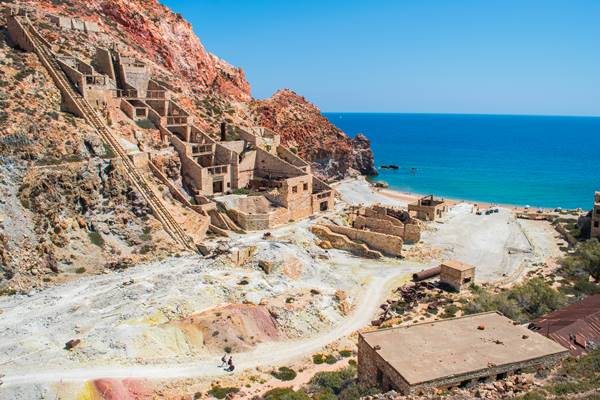
Old Sulfur Mines
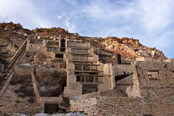
The Old Sulfur Mines of Milos are spread across the eastern part of the island, in a coastal area where industrial structures sit directly against the shoreline. The site includes remnants of processing facilities, loading platforms and rusted machinery that were once used to extract and transport sulfur from the surrounding deposits.
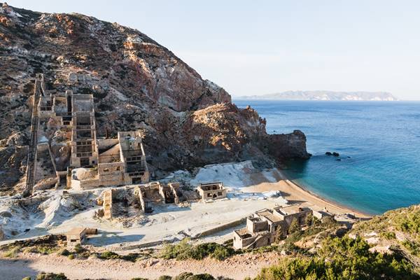
Walking through the area, the first impression is the contrast between the industrial remnants and the open sea just a few metres away. Conveyor frames, broken foundations and scattered equipment are still visible, though heavily weathered by salt, wind and time. Nothing has been restored, so the site reads more as a frozen working environment than a curated exhibition.
The coastline here is particularly exposed, and waves often reach the lower parts of the structures. This constant interaction with the sea has shaped both the remains and the surrounding rocks, which show layers of mineral staining and erosion tied to the mining activity that once took place here.
There are no marked routes or visitor facilities, so exploring the area is informal and based on following what remains of old paths and access roads. Some sections are easier to read than others, especially where larger industrial frames still stand upright against the landscape.
The mines are also tied to the broader mining history of Milos, which played a significant role in the island’s economy for decades. Visiting after the Mining Museum in Adamas helps make sense of what you are seeing on site, as many of the processes and equipment displayed there were originally used in places like this.
It is not a site that requires a long stay. Most visits involve a slow walk through the remains, pausing to look at how the structures interact with the coastline before moving on.
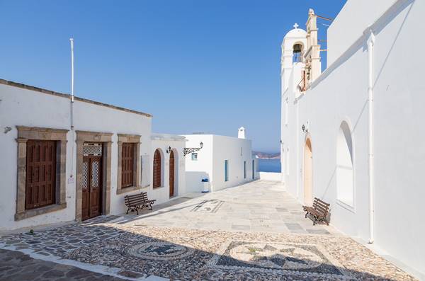
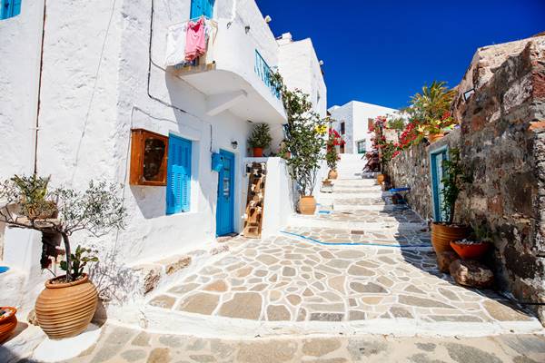
Plaka Village and Castle
Plaka sits on a hill above the natural harbour of Milos, where the streets were laid out long before cars or modern infrastructure changed how villages function. Getting there involves moving through narrow lanes that gradually climb upward, with stone houses packed closely together and small courtyards opening unexpectedly between them.
At the top of the village stands the remains of the Venetian castle, built in the 13th century when the island was part of the Duchy of Naxos. Only fragments of the structure remain today sections of stone walls, arches and foundations, but the position still reads clearly. It was chosen for visibility across the sea, and that same function now makes it one of the best viewpoints on the island.
The village itself is worth exploring before or after reaching the castle. Small shops, quiet side streets and residential corners sit away from the main path to the viewpoint. Details tend to stand out more than landmarks, doorways, stairways carved into stone, and terraces adapted to the slope of the hill.
From the castle area, the landscape spreads in multiple directions. You can see the full curve of the bay, the outline of nearby villages, and the layered volcanic hills that define much of Milos. Unlike lower parts of Plaka, the wind is more noticeable here, and the space feels more open, with fewer buildings interrupting the view.
Plaka and its castle are often visited around sunset, when people gather along the upper edges of the village to watch the light move across the island.
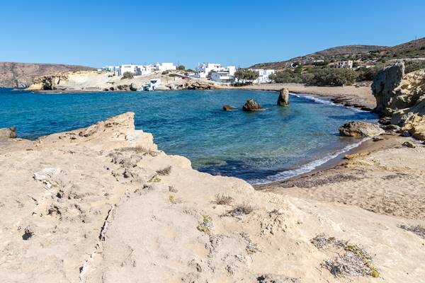
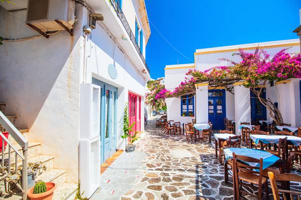
Pollonia Village
Pollonia sits at the northeastern tip of Milos, facing the small island of Kimolos across a short stretch of water. Unlike the island’s more rugged or elevated settlements, this village spreads gently along the coastline, following the curve of a sheltered bay where fishing boats and small ferries come and go throughout the day.
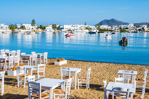
The main waterfront road is where most activity happens. Cafés and tavernas sit just a few steps from the sea, with tables often positioned close enough that you can hear the movement of the water beneath the harbour walls. The rhythm here is steady rather than busy, morning coffee, midday swims, and long, unhurried dinners as boats return in the evening light.
Pollonia also functions as a departure point for trips to Kimolos, and the small port reflects that role without feeling like a transit hub. Boats dock briefly, people come and go, and the village continues around it without interruption. Watching this flow is part of what gives the place its character.
A short walk away from the centre, the coastline becomes quieter. Small coves and low rocky edges replace the main beach, and the water remains shallow and clear for a long stretch out from shore. It is common to see people moving between swimming spots rather than staying in one place.
Vani Cape
Cape Vani sits on the northwestern tip of Milos, where the paved road ends and the landscape turns noticeably more raw. The final approach is along a rough dirt track that slowly removes any sense of settlement, leaving only open ground, rock formations and the sea in the distance.
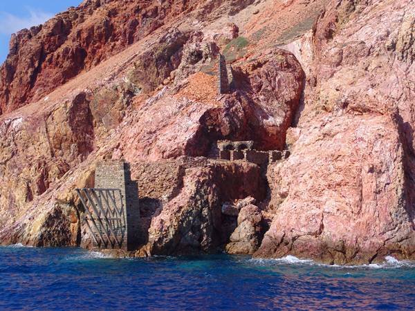
The headland is known for its abandoned manganese mine, which operated in the late 19th century. What remains today is scattered across the slope: partial stone structures, rusted metal fragments and old extraction points that blend into the terrain rather than standing apart from it. There is no restored site or organised route, so movement here follows what is still physically present on the ground.
The geology is the main feature. The cliffs and exposed rock layers show unusual colour bands, reds, browns and darker mineral streaks that locals often refer to as “bacon rock.” These patterns are not isolated formations but part of the entire coastline, which changes tone depending on light and viewing angle.
Cape Vani can be reached either by boat or by road. Most visitors arrive on day cruises that circle the western side of Milos on the way to Kleftiko, offering a clear view of the cliffs from the sea. By land, the drive from Adamas takes around 40 minutes, with the last section requiring a careful drive over an uneven dirt road, typically more suitable for higher clearance vehicles.
Sampling the Delicious Gastronomy of Milos
Milos, a picturesque Greek island known for its stunning beaches and rich history, also boasts a delectable culinary scene. Exploring the island’s gastronomy is a journey of indulgence in traditional Greek flavors and unique local delicacies. From fresh seafood caught daily by local fishermen to mouthwatering cheese varieties made with techniques passed down through generations, Milos offers a true feast for the senses.
Don’t miss out on trying the famous “pitarakia” – savory feta cheese pies filled with aromatic herbs – or savoring the island’s renowned thyme honey, produced by bees that roam freely amongst fragrant herbs.